Salvage Trails
The Salvage Trails consist of a series of short hikes such as Old Harry Cove, Southern Head, Doctor’s Pond, Net Point, Round Head, Burden’s Point, and to a lesser extent, Sprucey Hill and the Museum Trail. If you have a day where you’d like to see the best views of Salvage while walking the community, these trails are the way to do it.
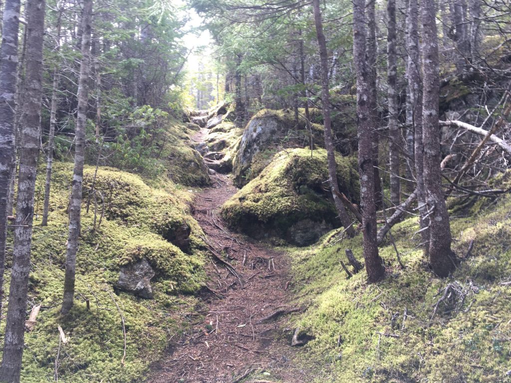
The trails wind around and through Salvage and are more moderate than the difficult Coastal Ridge Trail but not a good idea if you have mobility issues. At some points, the trail is pavement but at others, there are roots and rocks or grass- so be careful. Wet areas usually have a bridge crossing them but if the weather has been rainy, it’s best to wait until the ground dries up a bit.
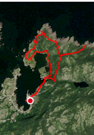
The route I take most often is Net Point (via Doctor’s Pond and Burden’s Point)-Old Harry Cove-Cemetery which is 4.17 km to and from the parking lot near the old fish plant. It’s recommended that you go clockwise, but you can also go in the opposite direction, especially if you are just interested in seeing the cemetery or only doing Southern Head or Old Harry Cove. The loop alone (Net Point-Doctor’s Pond-Cemetery) is 2.27 km to and from the parking lot. Burden’s Point is an 800 m detour that will bring you back to within 200 m of the main trail. Old Harry Cove is a 400 m side trail off the main loop and if you have the time, I highly recommend doing both of these additions as they are incredibly scenic. Southern Head is 1 km out to the lookout, adding 2 km to the total distance. However, I would rate the Southern Head portion as more difficult than moderate- there are a lot of uphill climbs, scrabbles over moss, a sort of ladder/stairs is set up against a vertical rockface and the lookout (while worth the 360-degree view of the peninsula!) is very windy.

There are a number of benches and rest stops along the Net Point trail. The first is 690 m in, the second is in 750 m and both overlook Doctor’s Pond and the Pickersgills’ homestead. The third is where the Burden’s Point and Net Point loops meet, either 800 m more, or 200 m more, respectively.
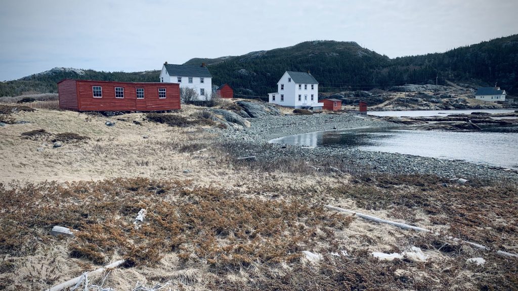
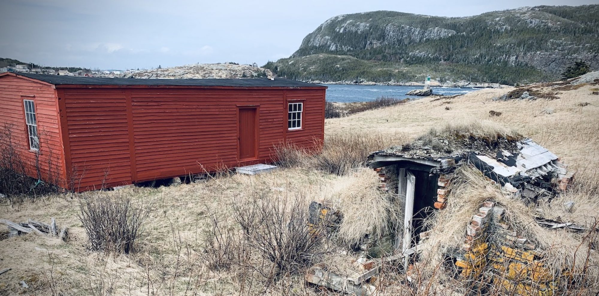
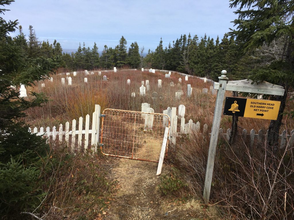
The loop to Burden’s Point is not marked, but there is a sign at the intersection that marks Net Point, leading up over a hill. Take the trail on the right and go towards the visible houses. This will take you past an old cemetery (the first on this trail) and bring you to a rocky beach area. The trail continues up over a hill after the beach and from this, you can rejoin the original trail.
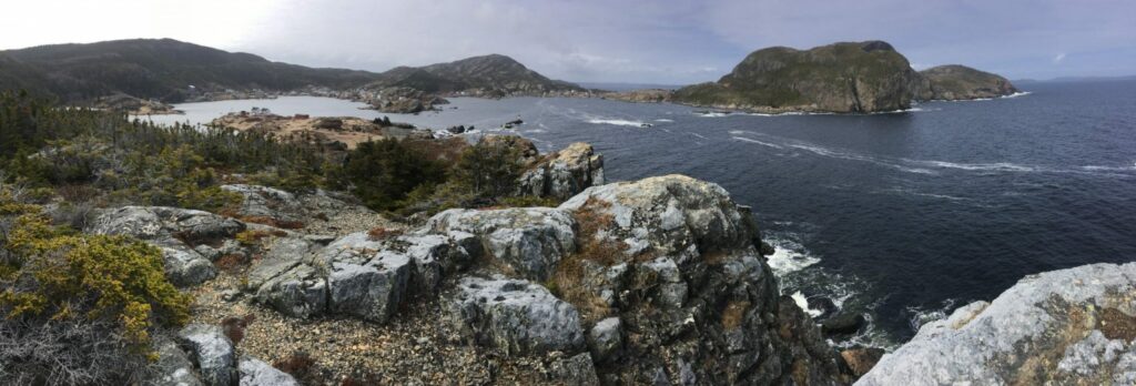
Net Point Lookout is approximately 2.1 km from the parking lot and overlooks Salvage, the harbour and many islands. It’s a great place to take a breather and enjoy the view. The storyboard there talks about the Eastport Peninsula’s fishing history and how the houses were floated from Flat Islands to Salvage and Eastport. It is difficult to read now but I have deciphered it here:
“Salmon and herring nets to the north, cod traps to the east and rope along the shore. This was the sight here on the point when the fishery was in full-force.
For many years, the fishery was a free-for-all and then in became competitive, fishermen would have to draw for their berths (or fishing area). Each season, licensed fishermen would take part in the draw. All would hold for a prime berth but had to accept whatever was drawn. The salmon and cod trap fishery are no longer, but fishers still use this point for herring nets which are used to catch bait for lobster traps.
For awhile, this was also the place to see houses being floated in on oil drums from the islands. Some of these houses and a fishing stage are now found in Salvage. ALl were floated in form Flat Islands. Thought not seen from here, the islands were once heavily populated; but by 1957, the majority of the population had begun to move. The houses were brought in around Shag Island to the right and Cow Head straight ahead. the only island still populated is St. Brendan’s, seen n the distance, which you can access from Burnside.”
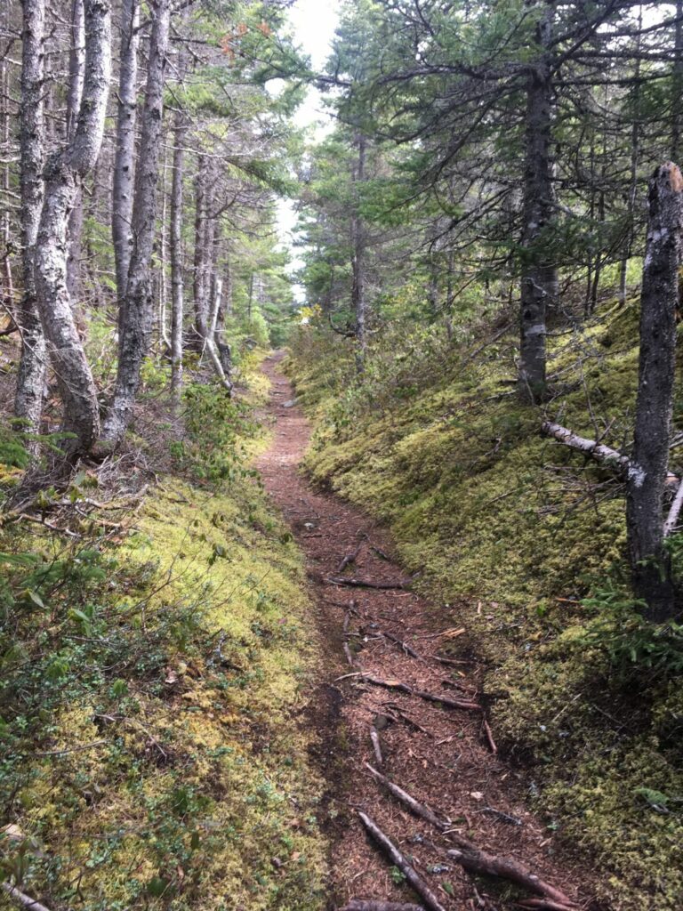
After Net Point, you will travel another 460m to get to the turn-off for Old Harry Cove. This 400 m trek to the lookout and picnic area there is my favourite of all the Salvage Trails. The uphill climb at the beginning is like you are walking through fairyland, with green moss covering the ground and the trees meeting overhead. It opens up into a wooden platform bridging a bog before returning back to a trail. It opens up into a viewing area where you get a close-up of the Shag Islands off Salvage. You might get to see a whale or two, some icebergs or fishing boats. And to top it all off, there’s a picnic table. I can think of no better place to enjoy your lunch (which, of course, you’re going to bring with you).

Once back on the main trail, you walk 116 m (or at the 3.30 km point) before reaching the turn-off for Southern Head. I don’t include this part of the trail very often, as I find that I have been gone for about an hour and a half at this point, but it is well worth a look. From this junction, the parking lot is another 870 m and you can see the second cemetery, which you will have to pass.
The last time I did Sprucey Hill and the Museum trails, they were not really well kept, but that was two years ago and they could have had work since then. I will have to go back and do them again and make an update. I enjoyed both, as they give different visual perspectives of Salvage but my favourites are still those trails leading from the fish plant.
Really, all the trails are lovely and there’s a very good chance you won’t regret doing any of them (unless you don’t bring a lunch…).